
The Atlas is not one mountain range. It is three, with different climates, terrain and crowds. Choosing the right range and the right month shapes your whole trip.
- The High Atlas, Middle Atlas and Anti-Atlas suit different walkers.
- Spring and autumn give the most comfortable conditions overall.
- A guided four-day loop from Imlil shows what a typical route involves.
What are the three Atlas ranges, and which one should you walk?
The Atlas stretches for about 2,500 kilometres across the northwest edge of Africa. It splits into the High Atlas, the Middle Atlas and the Anti-Atlas. Each has its own character.
High Atlas
This is the tallest and most dramatic range. It holds Toubkal, the highest peak in North Africa at 4,167 metres. You find snow-capped summits, deep gorges and remote Berber villages here. It is the range most walkers have in mind.
Middle Atlas
This is the northernmost range. Its slopes are heavily forested with oak and cedar. The air is cooler than in the towns below. It is the most fertile of the three. Several peaks pass 3,000 metres.
Anti-Atlas
This is the southernmost range. It begins near the Atlantic and runs inland. It is dry, rocky and lower. It is also the least visited, so you will find fewer places to sleep.
A quick way to choose:
- You want alpine terrain and snow: the High Atlas.
- You want forest and cooler air: the Middle Atlas.
- You want dry plateaus and few other walkers: the Anti-Atlas.
When is the best season for hiking in the Atlas?
Seasons matter more than most walkers expect. The range acts as a climate barrier. Northern slopes get heavier rain. Southern slopes are drier and fade toward the Sahara.
Spring and autumn are the safest choices for most routes. Spring runs from March to May and brings wildflowers. Autumn runs from September to November and brings comfortable temperatures. One source gives March to June as the best window, with snow still lying at higher altitudes.
High summer is hot in the lower valleys. Higher ground stays more pleasant. Most walkers avoid it in summer.
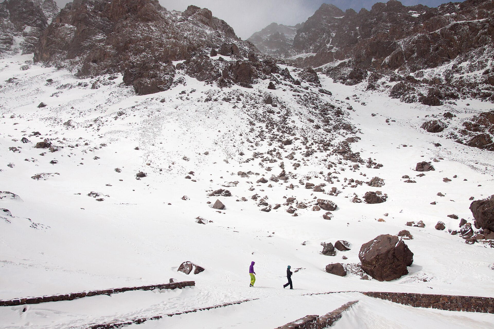
Winter brings snow to the High Atlas. That suits mountain sports. It is too cold and demanding for most trekkers. If you walk in early spring, expect snowfields on the upper slopes. You may need an ice axe, and crampons when snow and ice lie on the route.
Check the calendar before you book. During Ramadan and Eid al-Adha, many restaurants and shops close. That can change your daily rhythm, especially on food and supplies in villages.
What does a guided four-day High Atlas route look like?
A short guided loop from Imlil gives a clear picture of how a multi-day walk works. One operator describes a four-day version with a guide and a muleteer. The terrain follows old Berber tracks. They can be high, steep, narrow and rough underfoot. The trails are often exposed to the sun.
- Day one: a transfer from Marrakech to the trailhead at Imi Oughlad, at 1,450 metres. A short acclimatisation walk follows, then a picnic lunch. The night is in the village of Tahliouin.
- Day two: the route follows the Assif N’ait Oussaden valley. It climbs to the Tizi N’taghrhourte pass at 1,995 metres. It passes Assaka Spring and ends in the Tekkent valley.
- Day three: an ascent to Azib Tekkent, then the Tizi-n-Tegdalt pass at 2,700 metres. Views open over the Azzaden valley and Jebel Agelzim at 3,428 metres. The night is in Tizi Oussem.
- Day four: up the valley to the Ighoulidn waterfall. Then the Tizi n’Mezzik pass at 2,489 metres, and a descent to Imlil.
The route is rated moderate. It suits regular walkers with good fitness. No climbing experience is needed. Days two and three are the longer and harder ones.
There are no signposted trails in this remote area. That is why a local qualified guide supports the whole trip.
Where do you sleep, eat and find water?
Accommodation on routes like this mixes small, family-run gîtes with a mountain hut. Rooms are usually private. Bathrooms are shared. Single rooms are not always available.
Availability can force a change. If a gîte is full, an operator may place you in a tent outside the refuge. Ask how your operator handles this before you go.
Meals are simple and built around the walking day. A typical package includes breakfast, a picnic lunch on the trail and dinner at the night stop. Lunch often happens at a spring or beside woodland. Those stops are planned around water.
Some practical points on water and supplies:
- Carry enough for the stretches between springs.
- Treat any water you collect from streams or springs.
- Do not count on shops in remote villages, especially during Ramadan.
- Pack a small first aid kit.
Luggage can travel by mule. Ask your operator about weight limits and soft bags. Carry your own water, layers and valuables in a daypack.
How do you prepare for altitude, gear and village etiquette?
Dress as you would for an alpine trip. Pack warm layers, a weather-proof jacket, sturdy boots and a hat. Add a pair of sneakers to rest your feet at night. Bring a sleeping bag if the hut or gîte does not supply bedding.
Altitude deserves respect. Acclimatisation helps. Short first days, like the two-hour warm-up walk above, are a sensible pattern. Climb slowly, drink often and descend if symptoms worsen.
Weather can swing. Mountains can be dry in summer yet hit by storms. Freezing conditions are possible above 3,500 metres even in warm months. Ask your guide or the tourist offices in Marrakesh or Imlil about the state of the route.
On guides: Toubkal has qualified guides and porters for hire. Hire through a reputable local operator. Agree on what the price includes before you start.
In villages, a few habits go a long way:
- Greet people first and take time over it.
- Dress modestly, with covered shoulders and knees.
- Ask before photographing anyone.
- Accept tea when it is offered.
You will walk through places that rarely see visitors. Local music, architecture and language are part of the route. Walk slowly enough to notice them.
Frequently asked questions
Do you need a guide for hiking in the Atlas Mountains?
For most multi-day routes, yes. Trails in remote areas are often not signposted. A local qualified guide handles navigation and mule support. The Toubkal route is considered easy to navigate, but guides and porters can still be hired in Imlil.
What is the best time of year to hike in the Atlas?
Spring and autumn are the most comfortable. Spring runs from March to May and autumn from September to November. Summer is hot in the valleys and the Anti-Atlas. Winter brings snow to the High Atlas.
How hard is a four-day High Atlas trek?
One guided four-day route from Imlil is rated moderate. It suits regular walkers with good fitness and needs no climbing experience. Days two and three are the longer, harder days. Paths can be steep, narrow and uneven.
How long does it take to climb Toubkal?
Most people take two days. The first day goes up to the refuge from Imlil. The second day covers the summit and the return. The route is non-technical but needs good fitness because of the altitude.
Related reading
- Walking the Simien Escarpment: Geladas, Ras Dashen and Four Days on the Roof of Ethiopia
- Kilimanjaro Routes Compared: Machame, Lemosho and Marangu by the Numbers
Sources
- Hiking in the High Atlas Mountains Short Break (thenaturaladventure.com, accessed 2026-11-02)
- Exploring Morocco’s Atlas Mountains: Best Trails and … (roamingcamelsmorocco.com, accessed 2026-11-02)
- Top Tips on Hiking in the Atlas Mountains in Morocco (marocmama.com, accessed 2026-11-02)
- Toubkal — Wikipédia (en.wikipedia.org, accessed 2026-11-02)
Photo: Mount Toubkal in Winter, by Anass ERRIHANI, CC BY-SA 4.0 (Wikimedia Commons)