
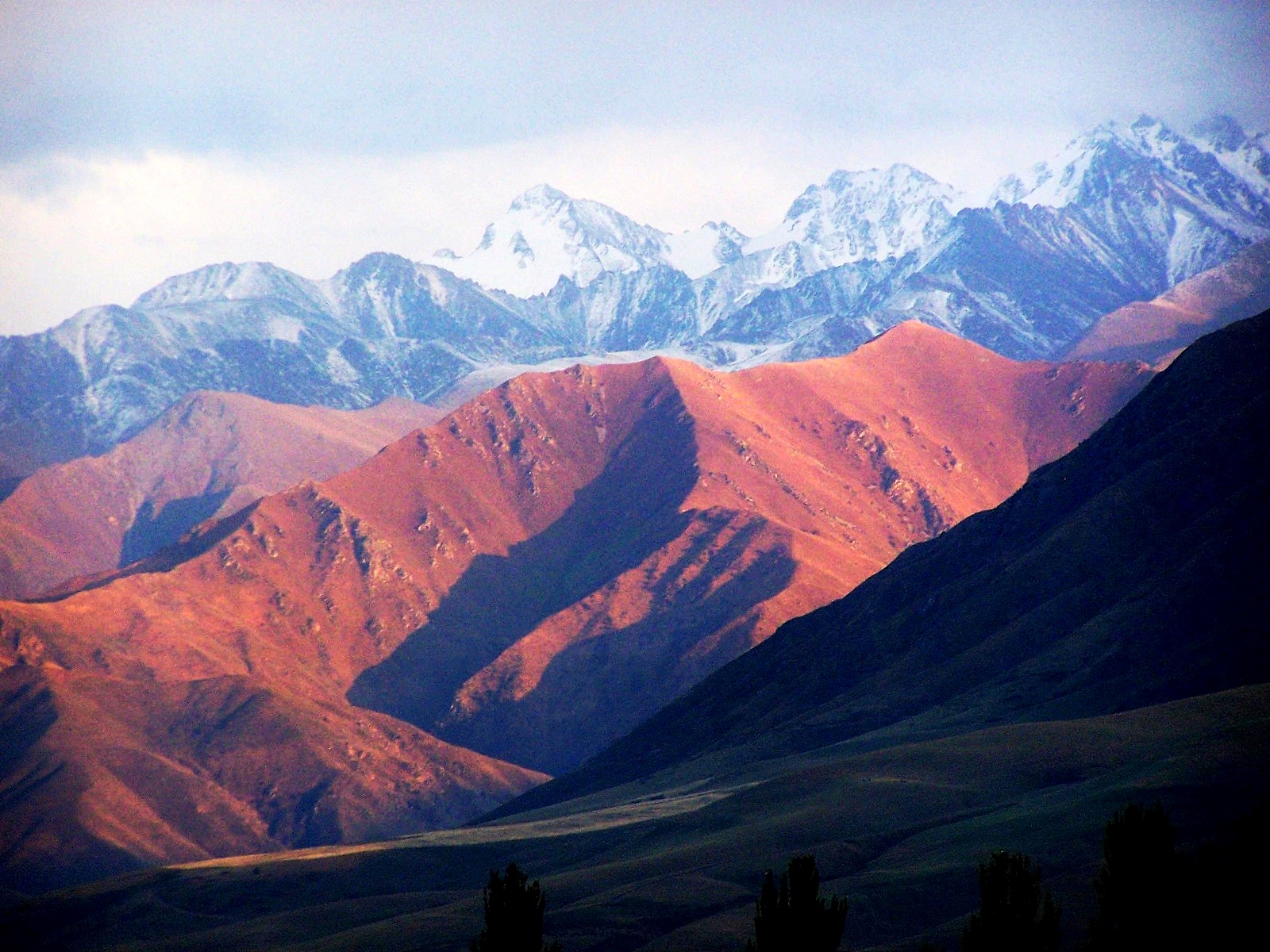
Kyrgyzstan is a country built of mountains. Knowing which range you are walking in explains the altitude, the weather and the way in. This guide gives you the geographic frame to pick a trek that fits you.
- Two systems dominate: the Tien Shan and the Pamir-Alay.
- The highest summit is Jengish Chokusu at 7,439 m.
- Your route choice depends on altitude, access and permits.
How much of Kyrgyzstan is mountain?
Nearly all of it. Sources disagree on the exact share, depending on how they define mountain terrain. The message is the same: flat ground is the exception.
This has a practical meaning for you. In much of the country, trekking is the only way to reach the wildest landscapes. Roads exist, but they follow the valleys.
The mountains also split the country. They divide it into a northern and a southern part. One road links the two: the Bishkek to Osh road.
Which ranges make up the Kyrgyz mountain map?
Two systems matter most to you.
The Tien Shan
The name means “Heavenly Mountains”. The system stretches from west to east and passes through several countries, but most of it lies in Kyrgyzstan. Sources give different lengths, around 2,500 to 2,800 km. Treat the exact figure as approximate.
Wikipedia groups the Kyrgyz ranges into orographic regions:
- Central Tien-Shan
- Northern Tien-Shan
- Inner Tien-Shan
- Western Tien-Shan
- South Tien-Shan
The Central Tien-Shan holds the highest ground. Glaciers cover about 40% of its area. Its ranges sit close together and narrow valleys cut between them.
Around Lake Issyk-Kul, two ranges face each other. The Terskey Ala-Too lies on the southern shore. The Kungey Ala-Too lies on the northern shore and forms the border with Kazakhstan.
The Pamir-Alay
This range lies in the south. It belongs to the Pamir system. Inside Kyrgyzstan it is represented by the northern slope of the Trans-Alay (Chon-Alay) Range and the Alay Depression. The city of Osh is relatively close.
Wikipedia describes the Alay region as markedly uplifted. Glaciers and snowfields cover the range.
The Fergana Range
The sources provided for this article do not cover the Fergana Range. For route planning there, look for a dedicated regional guide.
How high do the peaks go, and what does it mean for you?
Three summits top 7,000 m. Altitude figures vary a little between sources, so check the numbers before you commit to a route.
- Jengish Chokusu, also called Peak Pobeda, reaches 7,439 m. It is the highest mountain in Kyrgyzstan.
- Khan Tengri rises to 7,010 m on the Kazakh border.
- Lenin Peak reaches 7,134 m in the Trans-Alay.
Lenin Peak is called one of the easiest seven-thousanders in the world. That does not make it safe. Bad weather can make the ascent difficult and dangerous.
Trekkers rarely go that high. The Ala-Köl Pass, for example, sits at 3,900 m. That is already well into the range where altitude affects your pace and sleep.
Plan with these points in mind:
- Climb gradually and add rest days.
- Expect slower daily distances than at sea level.
- Heavy snowfall hides crevasses and can trigger avalanches on high ground.
- Weather can change fast, so keep a margin in your schedule.
Aspect matters too. The northern slopes are usually forested, so snow lasts longer there. The southern slopes carry steppe and summer meadows, and the sun shines longer.
Which trek matches your level?
Start with your experience, not with the most famous name. The Lonely Planet author describes Kyrgyz hiking as suitable for walkers of all levels. The routes below run from short to demanding.
Short and easy
- Shatyly Viewpoint is a short walk that pays off at dawn. A dirt road of 12 km leads to the start. There is no public transport, so you need a driver or guide.
- Shar Waterfall drops more than 400 m in the Naryn region. The climb is straightforward and moderate. The final 1.5 km crosses a high cirque.
Multi-day treks
- The Ala-Köl route climbs through pasture and spruce forest to a 3,900 m pass. It then drops into the Keldike Valley and on to the Altyn Arashan hot springs.
- The Ak-Suu Transverse takes about a week. It links Jyrgalan to the Jeti-Ögüz valley with one or two passes per day.
Remote ground
The Heights of Alay lie in the south. That route belongs to the Pamir-Alay, not the Tien Shan. Wikipedia names the Ak-Shyyrak massif as one of the major nodal uplifts of the country. Expect more isolation and less infrastructure in such places.
The sources provided do not describe it, so confirm current conditions locally.
What should you know about access, logistics and Tajikistan?
Permits are the first question. Many peaks were open in Soviet times, when no permits were needed to cross the border. Restrictions have eased since then. Special permits are still required in some places, because some areas involve difficult border crossings. Check the rules for your exact area before you travel.
Yurt camps are the logistical backbone of many routes. Families set up summer yurt camps on the jailoo, the high pastures. A network of yurt camps opened in 2024 along the Ak-Suu Transverse. It lets you avoid carrying a full pack over that distance. The role of CBT guesthouses is not covered in the sources provided, so verify it with the operator.
Season matters. The sources provided do not give dates for the trekking season or details on snow and river crossings. The safe approach:
- Ask local guides about snow on your specific pass.
- Ask about river levels before you commit to a crossing.
- Keep spare days in case a pass is blocked.
Many trailheads have no public transport. Plan for a private driver or a guide.
On the comparison with Tajikistan, the sources give one clear point. Only the northernmost part of the Pamir Highlands lies on the Kyrgyz-Tajik border. Pamir terrain spills into southern Kyrgyzstan as arid, dramatic slopes. Most of Kyrgyzstan’s trekking sits in the Tien Shan, with its green valleys and high pastures.
Frequently asked questions
What is the highest mountain in Kyrgyzstan?
Jengish Chokusu, also known as Peak Pobeda, is the highest at 7,439 m. It lies in the Central Tien Shan. It is a climbing objective, not a trek.
Do you need a permit to trek in Kyrgyzstan?
It depends on the area. Special permits are still required in some places, mainly near difficult border crossings. Ask your operator or guide to confirm before you go.
Is the Tien Shan the only mountain system in Kyrgyzstan?
No. The Pamir-Alay in the south belongs to the Pamir system. Its Kyrgyz part includes the northern slope of the Trans-Alay Range, where Lenin Peak stands at 7,134 m.
Can you trek in Kyrgyzstan without carrying a full pack?
On some routes, yes. Yurt camps offer room and board. A network along the Ak-Suu Transverse opened in 2024. Availability changes, so confirm it before you book.
Related reading
- Kolsai Lakes and Kaindy: Walking the Drowned Forest and the Three-Lake Valley of Kazakhstan
- Kyrgyzstan Beyond the Road: Song Kul, Kel-Suu and Nights in a Yurt
Sources
- Mountains of Kyrgyzstan (nomads-life.com, accessed 2026-11-09)
- Kyrgyzstan mountain ranges and passes. … – OrexCA.com (orexca.com, accessed 2026-11-09)
- 7 extraordinary mountain hikes in Kyrgyzstan (lonelyplanet.com, accessed 2026-11-09)
- List of mountain ranges in Kyrgyzstan — Wikipédia (en.wikipedia.org, accessed 2026-11-09)
Photo: Kyrgyzstan – Alatau mountains, by Bmg12060, CC BY-SA 2.5 (Wikimedia, via Openverse)