
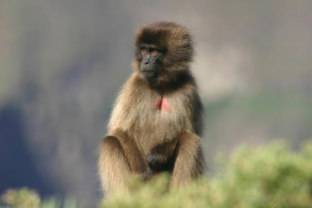
The Simien Mountains are not a range in the Alpine sense. They are the ragged northern edge of the Ethiopian highlands, a plateau of basalt at 3,500 to 4,000 m that ends in a wall of cliffs dropping 1,000 to 1,500 m to the lowlands. Walking here means walking along that edge for days, on grassland cropped short by geladas, past pinnacles that look like a cathedral collapsed sideways, with the lowland haze far below and the summit of Ras Dashen, at about 4,550 m the highest point in Ethiopia, somewhere across the valley. It is one of the most beautiful walks in Africa and one of the easiest to underestimate.
Geography of an escarpment
The Simien Mountains National Park was created in 1969 and was among the first sites inscribed on the UNESCO World Heritage list in 1978. The town of Debark, at about 2,850 m on the road north from Gondar, is the gateway; the park headquarters is here and every trek starts with paperwork in its office. Gondar has an airport, about 100 km and two to three hours by road from Debark, and Addis Ababa is a long day further south. The main trekking corridor runs east from the park entrance along the escarpment through three established camps: Sankaber at 3,250 m, Geech at 3,600 m and Chenek at 3,620 m. Beyond Chenek the trail crosses the Bwahit pass at about 4,200 m, descends steeply to the Meshaha river and climbs again to the village of Ambiko, the base for Ras Dashen.
The four-day core traverse
The standard four-day itinerary, and the one we would recommend to anyone on a first visit, covers the escarpment from the Buyit Ras area to Chenek and back out by vehicle. Day one is a gentle 12 km along the rim to Sankaber, at 3,250 m, with the first geladas usually within an hour. Day two, to Geech, is about 14 km and passes the Jinbar waterfall, which drops some 500 m into the Geech Abyss in the wet season and thins to a ribbon by February. Day three is the highlight: the round trip from Geech to the viewpoint of Imet Gogo at 3,926 m, a rock promontory with a 270-degree drop, followed by the traverse to Chenek, about 15 km with a good deal of up and down. Day four climbs from Chenek to the shoulder of Bwahit, at 4,430 m the second-highest peak in the park, before returning to camp and the road. Total distance is roughly 60 km with cumulative ascent around 2,500 m, on trails that are mostly easy underfoot but never flat for long.
Adding Ras Dashen
Ras Dashen (also spelled Ras Dejen) is not on the four-day route. Reaching it means continuing from Chenek over the Bwahit pass, dropping about 1,000 m to the river and climbing to Ambiko at roughly 3,200 m, then making a long summit day of about 1,350 m of ascent and 20 km round trip. The final section is a short scramble on broken volcanic rock, easy in dry conditions. The usual plan is seven or eight days from Debark, with the return either retracing the escarpment or walking out to the north through villages. The summit is not spectacular in itself, a rounded top among several similar ones, but the days spent getting there, through highland farms and barley terraces where the road ends and the mule trains start, are as memorable as the cliffs.
Geladas, ibex and wolves
The gelada is the animal everyone comes for and it does not disappoint. Often called a baboon, it is in fact the last surviving member of a separate genus of grass-eating primates, found only in the Ethiopian highlands. Troops of several hundred graze the escarpment meadows, sitting on their haunches and plucking grass with a dexterity that looks oddly human. The males have a mane and a bare red patch of skin on the chest that gives them the name bleeding-heart monkey. Around Sankaber and Chenek you can sit within a few metres of a troop for an hour without alarming them; the rule is simply not to feed or corner them. The Walia ibex, endemic to the Simiens and reduced to a few hundred animals, is best seen on the cliffs below Chenek in the early morning. The Ethiopian wolf, the rarest canid in the world, survives in small numbers on the Afro-alpine grassland around Bwahit and Ras Dashen, and a sighting is a matter of luck and patience.
Seasons, altitude and the practicalities
The dry season runs from October to March and is the only sensible time for a traverse. October and November are green from the rains, with the waterfall at full flow; January and February are drier, dustier and colder at night, with frost at Geech and Chenek, but with the most reliable views. The main rains fall from June to September and turn the trails to mud and the escarpment to cloud. Days are warm in the sun at 3,500 m, around 15 to 20 degrees C, and the equatorial sun at that altitude burns quickly; nights drop to freezing at every camp.
Altitude is the quiet hazard. Most visitors drive from Gondar at 2,100 m to Debark and are sleeping at 3,250 m the same evening, then at 3,600 m the next; the Bwahit and Ras Dashen days go well above 4,000 m. Headaches on the first two nights are common and are the reason not to rush the itinerary.
- Every group must hire an armed park scout, and most also take a licensed guide; both are arranged at the Debark office and paid per day.
- Park entry, camping and scout fees are charged per person per day and are paid in local currency in cash.
- Mules and mule handlers carry the camping gear; the camps have basic shelters but no supplies, so everything comes with you.
- Bring a four-season sleeping bag, a sun hat and water treatment; streams are shared with livestock.
Walking with respect
The Simiens are not empty. Villages and fields lie inside the park boundary, children herd goats along the trails and the escarpment paths double as the road to market. That gives the trek a warmth the great volcanoes lack, and it asks for some care: buy what you can locally, ask before photographing people, and keep to the paths across cultivated land. Four days on the edge of the plateau, with the geladas grunting in the grass and the lowlands smoking 1,000 m below, will change your idea of what an African mountain looks like.