
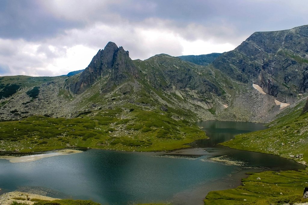
The Fann Mountains are the range that Central Asian trekkers keep to themselves. They lie in the north-west of Tajikistan, between the Zeravshan and Hissar ranges, an hour’s drive from the border with Uzbekistan and a world away from the deserts on the other side of it. Peaks rise to 5,489 metres at Chimtarga, the highest in the range, and between them sit lakes of a colour that looks invented. We came for two weeks, walked two of the classic routes, and left convinced that this is the finest accessible high-mountain trekking in the region.
Where the Fanns are and how to reach them
The range belongs to the Sughd region of Tajikistan, and the town of Panjakent, at about 1,000 metres on the Zeravshan river, is the base. Panjakent lies only 60 kilometres from Samarkand, and since the border crossing reopened in 2018 it has been the normal way in: a morning taxi from Samarkand, an hour at the frontier, and lunch in Tajikistan. Dushanbe, the capital, is a five to six hour drive to the south over the Anzob pass and through a long tunnel.
From Panjakent, rough roads climb into three main valleys: the Shing valley with its Seven Lakes, the Artuch valley leading to the Kulikalon basin, and the Pasrud valley leading to the Alaudin lakes and Iskanderkul. Shared jeeps and arranged drivers cover the distances in two to four hours.
The Seven Lakes: a valley walked upward
The Seven Lakes, known in Tajik as Haft-Kul and sometimes as the Marguzor lakes, are a chain of lakes strung up the Shing valley, each one dammed by an ancient landslide and each a different colour. The lowest, Mijgon, sits at about 1,600 metres; the highest, Hazorchashma, at about 2,400 metres. Between them come Soya, Hushyor, Nofin, Khurdak and Marguzor, the largest, with the village of Padrud on its shore.
A road follows the valley as far as the sixth lake, so the walk can be done as a drive with short strolls, or, as we did it, on foot from the first lake to the last over two days, about 20 kilometres with 800 metres of ascent. Villages line the lower lakes, with homestays in Nofin, Padrud and Marguzor where families serve plov, fresh bread and mulberries from the courtyard trees. Above the seventh lake the valley continues empty toward the passes to the Kulikalon side; strong walkers link the two areas over the Tavasang pass at around 3,300 metres in another two days.
Kulikalon and the Alaudin lakes: the classic high loop
The heart of the range is the loop between the Kulikalon basin and the Alaudin lakes. From the Artuch valley, a day’s walk climbs to the Kulikalon lakes at about 2,800 metres, a bowl of turquoise and green water beneath the 5,000 metre wall of the Chapdara and Maria peaks. It is one of the great mountain camps of Asia, and in July the meadows hold a few shepherd camps and a handful of tents.
From Kulikalon the route crosses the Alaudin pass at 3,860 metres, a steep scree climb and a long descent, to the Alaudin lakes at about 2,780 metres. The lakes are smaller and the colour deeper, with juniper on the shores and Chimtarga’s north face across the valley. A second pass, the Laudan at about 3,630 metres, leads back to Artuch, closing a loop of around 45 kilometres in four to five days. Ambitious parties add the Chimtarga pass at about 4,750 metres and the Mutnye lakes, a serious extension that needs acclimatisation and settled weather.
Iskanderkul: the lake that ends the road
South-east of the Alaudin valley, Iskanderkul is the largest lake in the Fanns, about 3.4 square kilometres at 2,195 metres, named for Alexander the Great in the local legend that says his army passed this way. A road reaches it from the Dushanbe highway, and it is the most visited spot in the range, with a small tourist base and picnic groups at weekends. For walkers it is a fine rest day: a path around the shore, a waterfall below the outlet about 40 metres high, and the quiet side valley to the small lake called Snake Lake. It also makes a good end point for a traverse that starts at Artuch and comes over the passes from the west.
Seasons, weather and altitude
The Fanns are dry mountains. The trekking season runs from late June to late September; in July and August the valleys are hot, the passes clear and the weather largely stable, with far fewer storms than the Caucasus. Snow lingers on the Alaudin and Chimtarga passes into early July. Nights at the high lakes drop below freezing from late August. There is no water problem in the lake basins, but the passes are long, sun-baked and shadeless.
Altitude is the main thing to plan around. The camps at 2,800 metres are comfortable; the passes near 3,900 metres are not for a first day. Two nights at Kulikalon before the Alaudin pass is the sensible pattern.
Practical notes
Most nationalities now enter Tajikistan on an electronic visa arranged before travel. The Fanns lie outside the border-permit zones of the Pamirs, so nothing further is needed. Homestays exist in the lower valleys, but the high loop is a camping trek: tent, stove, food for the days above the villages, and a filter. Donkeys and their handlers can be hired in Artuch and the Shing villages to carry loads. Cash in the local currency is essential beyond Panjakent.
- Seven Lakes: 20 kilometres, 1,600 to 2,400 metres, two days with village homestays.
- Kulikalon to Alaudin loop: about 45 kilometres, passes at 3,860 and 3,630 metres, four to five days.
- Season: late June to late September; best in July and early September.
- Access: Panjakent from Samarkand in about two hours including the border.
We had heard the Fanns described as an easier Pamir. That undersells them. The passes are real, the lakes are the colour of a stone we had never seen before, and the villages along the Seven Lakes are as welcoming as any we know. Go before the road reaches the seventh lake.
Read next: Kyrgyzstan Mountains: Ranges, Altitudes and How to Choose Your Trek