
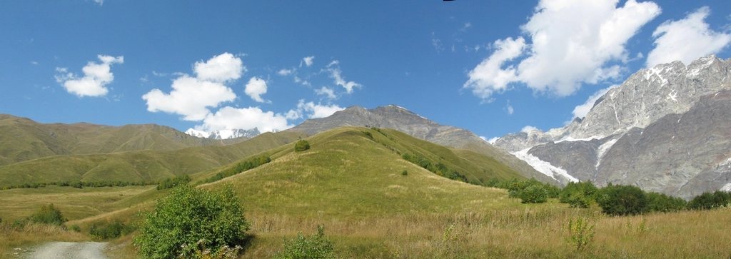
There is a moment on the second morning, somewhere above the village of Zhabeshi, when the towers stop looking like a curiosity and start looking like an argument. Dozens of them, square and grey, planted on every ridge and in every hamlet, each one a family’s answer to raids, blood feuds and winters that cut the valley off for months. The walk from Mestia to Ushguli is the classic way to read that argument slowly. Four days, roughly 55 to 60 kilometres, and a climb from 1,500 metres to just above 2,100 metres, with the highest peak in Georgia waiting at the far end.
Why this route, and why walk it rather than drive it
A rough road now links Mestia and Ushguli, and a jeep can cover the distance in two to three hours. We still recommend walking. The road follows the Enguri gorge; the trail climbs over the ridges between the side valleys, passing through villages the road never touches. Each night ends in a different community, and each day has a real high point, so the journey has a rhythm that the drive simply does not.
Upper Svaneti has been on the UNESCO World Heritage list since 1996, largely because of these villages and their towers. Most of the towers were built between the 9th and 13th centuries, and many are still attached to a family house. Seeing them from the trail, at walking speed, is the whole point.
Day one: Mestia to Zhabeshi
Mestia sits at about 1,500 metres and is the administrative heart of the region, with a museum, shops and a small airport that receives flights from near Tbilisi when the weather allows. Most people arrive instead by minibus from Zugdidi, a drive of around three hours on a mountain road.
The first stage is the gentlest: about 15 kilometres, mostly following the Mulkhura river upstream through a string of villages. Some walkers take the higher variant over the ridge for the views of Ushba, the twin-summited 4,710 metre peak that dominates the skyline west of Mestia. Zhabeshi, at around 1,600 metres, is a working farming village with a handful of family guesthouses, and it is where the towers begin to feel like a landscape rather than a monument.
Day two: Zhabeshi to Adishi over the Tetnuldi shoulder
The second day is short in distance, around 10 to 12 kilometres, but it climbs hard. The trail rises through beech and pine to the open slopes below the Tetnuldi ski area, topping out on a broad ridge at roughly 2,600 metres before dropping to Adishi. From the ridge, the mass of Tetnuldi itself, 4,858 metres, fills the view to the east.
Adishi is one of the most atmospheric villages in the valley. It sits at about 2,040 metres, was nearly abandoned in the 1980s after avalanches, and has slowly been repopulated. The towers here are dense and close, and the evening light on them is worth arriving early for.
Day three: the river crossing and the Chkhutnieri pass
This is the day everyone talks about. An hour beyond Adishi the trail reaches the Adishchala, a grey glacial river fed by the Adishi glacier. There is no bridge. The crossing is possible on foot in the early morning, when overnight cold reduces the melt, but the water is fast, knee to thigh deep and painfully cold. Local families wait with horses and will carry walkers across for a modest fee. We took the horse and did not regret it.
From the river the path climbs steadily to the Chkhutnieri pass at about 2,720 metres, the high point of the whole route. On a clear day the glacier tongue and the wall behind it are the best mountain view of the trek. The descent to Iprali and the neighbouring hamlets of Khalde and Bogreshi is long and hot in the afternoon. The stage is around 17 to 18 kilometres and takes most walkers seven to eight hours including the crossing.
Day four: Iprali to Ushguli
The final stage is about 12 kilometres, partly on the jeep road and partly on a trail above it. Some of the road section is dusty when traffic passes, so we left early. The valley opens as it climbs, the trees thin out, and then the towers of Ushguli appear on the skyline in a way that no photograph quite prepares you for.
Ushguli is a group of four hamlets between roughly 2,060 and 2,200 metres, often described as one of the highest continuously inhabited settlements in Europe. Above the highest hamlet stands the small church of Lamaria, and beyond it the valley runs up to the foot of Shkhara, at 5,193 metres the highest mountain in Georgia. With a spare day, the walk to the Shkhara glacier viewpoint is about 8 kilometres each way on easy ground and is the best possible way to finish.
Practical notes: season, sleeping, food and money
The route is normally walkable from mid-June to early October. Snow can linger on the Chkhutnieri pass into June, and in September the nights already drop close to freezing at Ushguli. July and August are busiest and also bring afternoon thunderstorms, so early starts are sensible every day.
No permit is needed. Every stage ends in a village with family guesthouses that provide dinner, breakfast and usually a packed lunch, so there is no need to carry a tent or stove unless you want to. Bookings by phone or through the guesthouse networks are advisable in peak season, but outside it we simply walked in. Cash is essential: there is a bank machine in Mestia and nothing reliable beyond it.
- Distance: about 55 to 60 kilometres over four stages of 10 to 18 kilometres.
- Elevation: start 1,500 metres, high point 2,720 metres, finish around 2,100 metres.
- Season: mid-June to early October; best weather usually late August to mid-September.
- Water: streams are plentiful but grazing is everywhere, so filter or treat.
- Return: shared jeeps run from Ushguli back to Mestia most days in season.
We walked it in early September, with the first snow dusting Shkhara and the hay already cut in Adishi. It is not a technical trek, but it is a proper one, and the river crossing, the pass and the altitude deserve respect. What stays with us, though, is not the difficulty. It is the towers, still standing, still lived beside, still making their argument to anyone who walks past slowly enough to hear it.