
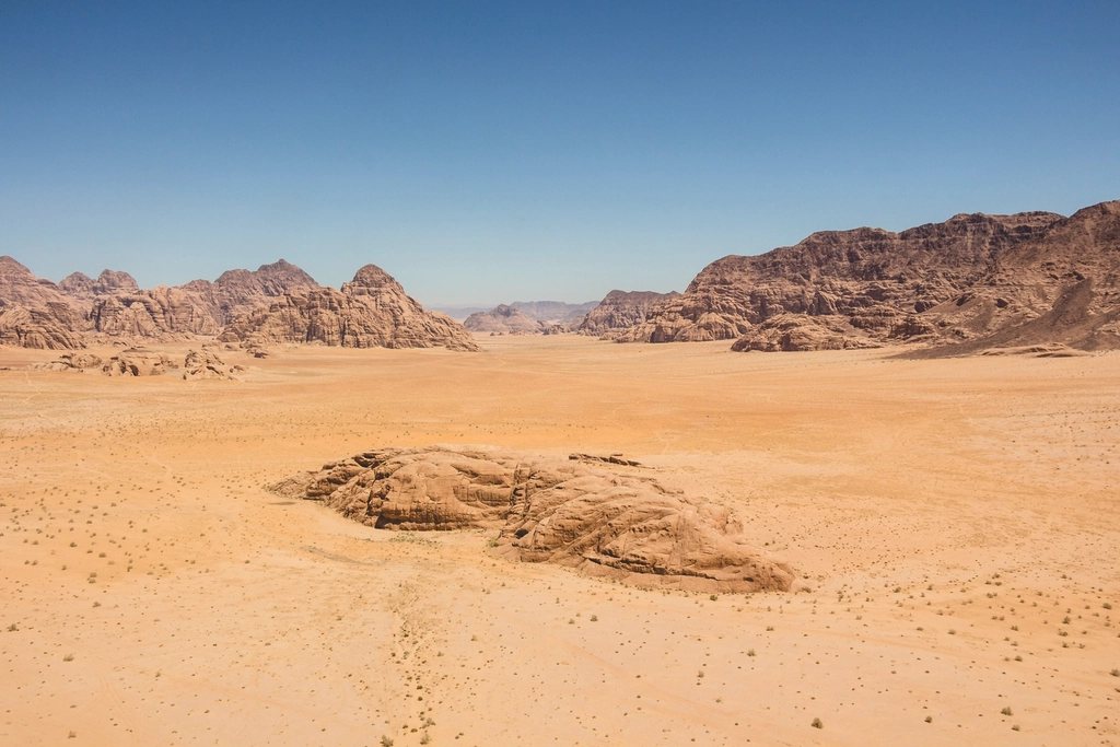
The Jordan Trail is one of those long-distance routes that reads like a compressed history of the Levant. In 675 km it crosses the whole country from north to south, from the Roman city of Gadara at Umm Qais, where the hills drop towards the Yarmouk river and the Sea of Galilee, to the Red Sea at Aqaba. Between the two lie olive groves and oak forest, the basalt and limestone canyons that cut down to the Dead Sea, the high plateau of the King’s Highway, the sandstone country of Dana and Petra, the granite and sand of Wadi Rum, and finally a last dry descent to the coast. Walking it end to end takes 36 to 45 days. Many more people walk one of its eight sections, and the most popular by far is the four-day stretch from Dana to Petra.
Eight sections, one country
The trail was formalised in 2015 and 2017 by a Jordanian non-profit association, stitching together shepherd paths, old Ottoman roads, wadi beds and a few stretches of tarmac. It is waymarked only intermittently, so a GPS track and a paper map are essential. The eight official sections run roughly as follows: Umm Qais to Ajloun (about 80 km) through the greenest and most farmed part of the country; Ajloun to Fuheis (about 65 km) across the wooded hills north-west of Amman; Fuheis to Zarqa Ma’in (about 75 km) as the landscape dries and the first hot springs appear; the Three Wadis section from Zarqa Ma’in to Karak (about 75 km), which drops in and out of the Mujib, Hidan and Karak canyons; Karak to Dana (about 85 km) along the edge of the plateau; Dana to Petra (about 80 km); Petra to Wadi Rum (about 110 km) through empty sandstone country; and Wadi Rum to Aqaba (about 105 km).
The character changes completely from north to south. In the first week you walk between villages and buy bread and tomatoes in small shops. By the last week you are carrying several days of food and the only people you meet are Bedouin families with their goats. Water is the recurring theme: springs and taps in every northern village, pre-arranged water drops and unreliable cisterns in the south.
Seasons, heat and altitude
The trail is a spring and autumn route. March to early May is the classic window: the northern hills are green, wildflowers cover the slopes around Ajloun, and daytime temperatures in the Jordan Valley and Wadi Araba are still bearable at 25 to 32 C. October and November work equally well, with a drier landscape and more stable weather. Summer is genuinely dangerous in the low sections. Wadi Araba and the shores of the Dead Sea lie below sea level, the Dead Sea itself at about minus 430 m, and afternoon temperatures there regularly pass 40 C from June to September. Winter, on the other hand, brings cold rain and occasionally snow to the plateau, and flash floods to the canyons; anyone walking the Three Wadis section between December and February needs to watch the forecast carefully.
Altitude is modest but the relief is not. The trail rises to around 1,500 m on the plateau south of Karak and drops close to 400 m below sea level in the wadis, so daily elevation change is often 1,000 m or more, much of it on loose ground under a strong sun.
Dana to Petra: the classic four days
If you only have a week in Jordan, this is the section to walk. It starts in the stone village of Dana, perched at about 1,200 m on the lip of a huge natural amphitheatre, and ends at the back door of Petra. The first day drops around 900 m through the Dana Biosphere Reserve, the largest nature reserve in the country, following Wadi Dana as the vegetation changes from Mediterranean scrub to acacia and desert. The path is well defined, but the heat builds as you lose altitude. You finish at Feynan, a low, hot, copper-mining landscape that has been worked since the Bronze Age, at roughly 300 m above sea level.
Day two is the hardest and, in our opinion, the most beautiful: a long climb of about 1,000 m out of Wadi Feynan and over the shoulder of the mountains through Wadi Malaga, on shepherd paths that alternate between sand, scree and slabs of red sandstone. Day three crosses a high, empty landscape around Ras al-Feid before descending towards the outlying farms of the Bedouin villages north of Petra. Day four is the reward: you walk into Little Petra, a small Nabataean site with a cistern and carved facades, and then follow an old caravan route through the hills to reach Petra from the north, arriving at the Monastery, the Ad Deir, from above rather than climbing the 800 steps most visitors use. From there you descend into the main site and out through the Siq to the town of Wadi Musa.
Logistics and etiquette
The Dana to Petra section is typically done with a local guide, mule support and camping, though strong walkers with good navigation skills do it independently. Camping is possible almost everywhere outside the nature reserve; inside Dana Biosphere Reserve you need to arrange permission and use designated spots. Entry to Petra requires a paid ticket for each day you are inside the archaeological site, and the price is significantly lower for visitors staying at least one night in Jordan. Guides in the Petra region must be licensed. Elsewhere on the trail there is no permit system, but there are military checkpoints near the borders at both ends, so carry a passport.
A few points of respect matter. Much of the route crosses grazing land and family property; ask before camping near a tent or a house. Dress modestly in villages, accept tea when offered, and do not photograph women without explicit permission.
What to carry
- Water capacity of at least 4 litres per person, more in the south, and a filter or tablets for cisterns and springs.
- A GPS track on a phone plus a paper map; the waymarking is intermittent and the wadis are confusing.
- Sun protection: a wide hat, long sleeves, high-factor cream; shade is rare south of Karak.
- A sleeping bag rated to around 0 C for spring and autumn nights on the plateau.
- Shoes with good grip and ankle support; loose scree and sandstone slabs are the norm.
- Cash in small notes for food in villages and for guides, mules and water drops.
Is it for you?
The Jordan Trail is not technical: no glacier, no fixed rope, no summit to speak of. Its difficulty is cumulative: heat, dry air, long days, heavy packs and route-finding through country that looks the same in every direction. In return it offers landscapes that change every day, layers of history from the Nabataeans to the Ottomans, and a level of everyday hospitality that most of us had never met on a trail before. Walk Dana to Petra as a first taste, in April or late October, and the full traverse if you have six weeks and a strong tolerance for dust.