
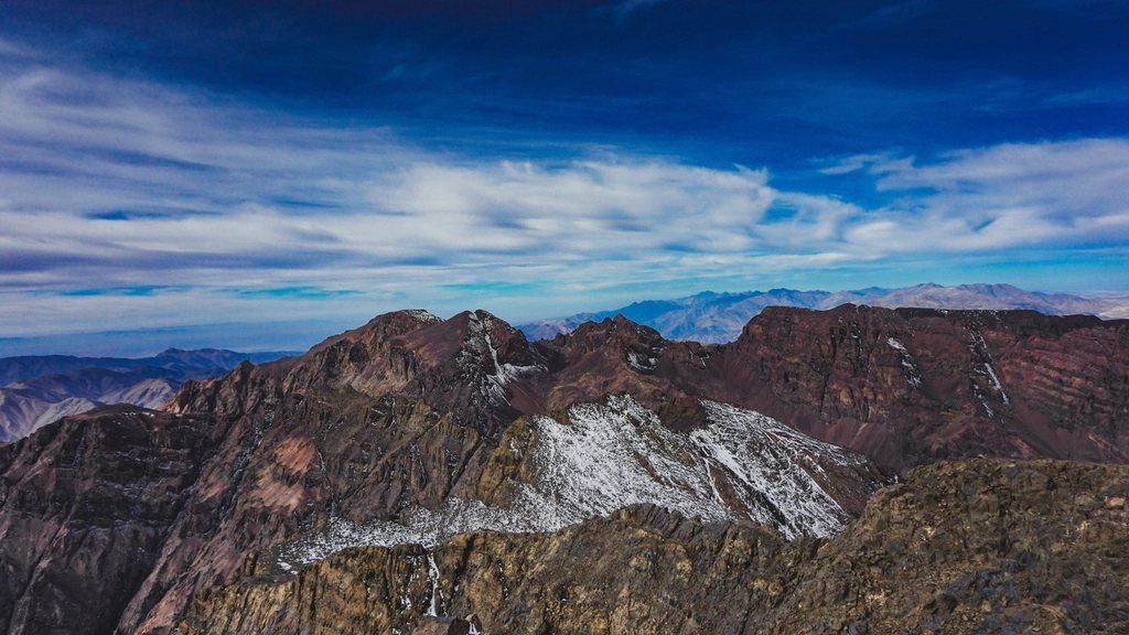
Every visitor to Georgia seems to end up in Stepantsminda, the town everyone still calls Kazbegi, standing in the main square and looking up at a church on a hill and a mountain behind it. The church is Gergeti Trinity. The mountain is Kazbek, 5,054 metres, a dormant volcano wrapped in glaciers. Most people take a jeep to the church, take a photograph and leave. We think the valley deserves at least three days: one for the church and the slopes above it, and two for the Chaukhi pass, a high crossing from the village of Juta into the neighbouring region of Khevsureti.
Getting there along the Georgian Military Highway
Stepantsminda sits at about 1,740 metres, roughly 150 kilometres north of Tbilisi and only a few kilometres from the Russian border. The road is the Georgian Military Highway, built in the 19th century and still the only paved route across this part of the range. Shared minibuses from Tbilisi take about three hours, climbing past the reservoir at Zhinvali, the fortress at Ananuri and the Jvari pass at 2,395 metres before descending into the Terek valley.
The highway carries heavy lorry traffic to and from the border, and in winter and spring it closes for avalanches. For a walker this matters only in one way: the town is easy to reach, cheap to stay in, and busy. Guesthouses are everywhere, and prices in July and August are higher than anywhere else in the Georgian mountains.
Gergeti Trinity Church: walk it, do not drive it
The church stands at 2,170 metres on a grassy shoulder above the village of Gergeti, across the river from the town. It was built in the 14th century, and for centuries it was where the treasures of the Georgian church were hidden in times of invasion. A paved road now reaches it, and jeeps shuttle tourists up and down all day.
The walking route starts in Gergeti village and climbs steeply through a birch wood, then across open pasture, gaining about 430 metres in roughly 3 kilometres. It takes an hour and a half at a steady pace. Go early: by nine in the morning the car park is full, and by seven the hill is nearly empty, with Kazbek turning pink behind the bell tower.
With a full day, the path continues above the church toward the Gergeti glacier. The trail climbs to a viewpoint at around 3,000 metres in another three hours, with the glacier tongue and the icefall in full view. Beyond that, the route to the old meteorological station at 3,653 metres crosses the lower glacier and belongs to acclimatised, equipped parties only. We turned around at the viewpoint, and it was enough.
Juta: the highest village in the valley
The second part of the trip begins in the Sno valley, which branches east from the highway a few kilometres south of the town. Juta is the last village, at about 2,150 metres, around 20 kilometres from Stepantsminda on a gravel road. Taxis and shared jeeps make the run, and in season a few families in Juta take in walkers.
Above the village, the Chaukhi massif rises in a wall of grey spires to 3,842 metres. It is the closest thing the Caucasus has to the Dolomites, and the meadows below it, with a couple of seasonal camps near 2,400 metres, are a fine place to spend an afternoon even if you go no further.
The Chaukhi pass: Juta to Roshka in one long day
The crossing from Juta to Roshka is about 16 kilometres with roughly 1,200 metres of climbing and 1,350 metres of descent, and most parties take seven to nine hours. The path leaves the meadows and climbs steadily up the valley east of the spires, on grass and then scree, to the Chaukhi pass, also called the Roshka pass, at 3,338 metres.
The pass itself is a narrow saddle. To the west, the whole Chaukhi wall; to the east, the ranges of Khevsureti stacking away toward Chechnya. The descent is steep and loose at first, then eases past the three Abudelauri lakes, sitting between about 2,800 and 3,000 metres. They are known locally by colour, blue, green and white, and the white one, milky with glacial silt, is the highest. Below the lakes the trail drops through rhododendron and juniper to the hamlet of Roshka at around 2,000 metres, where a few houses host walkers and a rough road leads out to the Khevsureti valleys.
The crossing can be done in either direction. Starting from Juta means a shorter, steeper climb and a longer descent; starting from Roshka reverses that. Camping is possible on the Juta side and near the lakes, which turns the day into a gentler two-day walk.
Seasons, weather and altitude
Gergeti church can be walked from May to October, though the glacier trail above it holds snow into June. The Chaukhi pass is a July to September route. Earlier, the north side of the pass is a snow slope; later, early storms can close it in a day. Afternoon cloud builds fast on the Chaukhi wall in summer, so we were on the pass before eleven.
The pass is high enough to matter. Coming straight from Tbilisi, most people feel it. A night in Stepantsminda and a walk to the church first make the crossing much more comfortable. There are no permits to arrange, but the area near the Russian border is patrolled and the trails around Juta and Roshka are well inside Georgian territory. Cash, a filter, warm layers and a real map are the essentials.
- Gergeti church: 3 kilometres, 430 metres of climb, about 90 minutes from Gergeti village.
- Glacier viewpoint: add about 3 hours and 800 metres of climb.
- Chaukhi pass: 16 kilometres, high point 3,338 metres, 7 to 9 hours.
- Season: church May to October; pass July to September.
Stepantsminda will always be a place people pass through in an afternoon. Give it three days, and the church becomes a warm-up, the glacier becomes a long morning, and the pass into Khevsureti becomes the kind of walk that a trip is remembered for.